

Remote Sens. 2024, 16(9), 1623; https://doi.org/10.3390/rs16091623 - 01 May 2024
Abstract
In recent decades, eutrophication in inland and coastal waters (ICWs) has increased due to anthropogenic activities and global warming, thus requiring timely monitoring. Compared with traditional sampling and laboratory analysis methods, satellite remote sensing technology can provide macro-scale, low-cost, and near real-time water
[...] Read more.
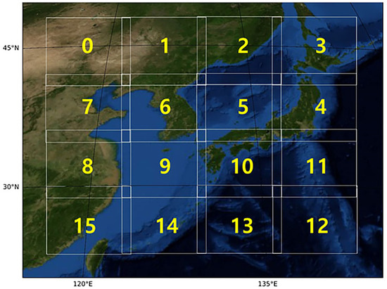
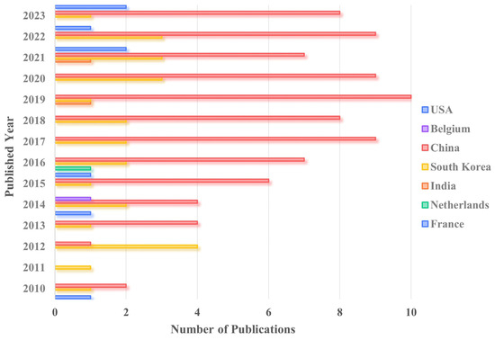
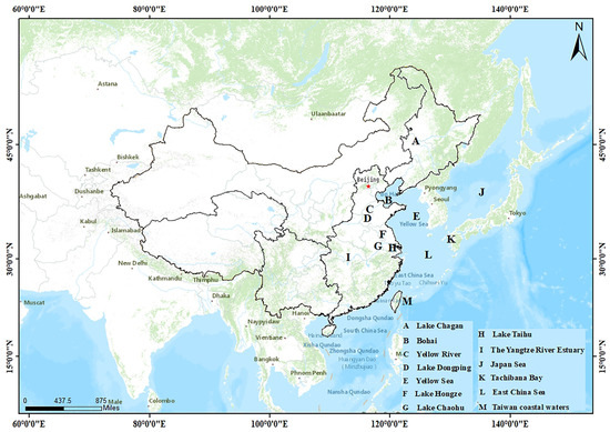
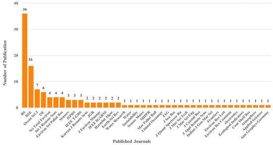
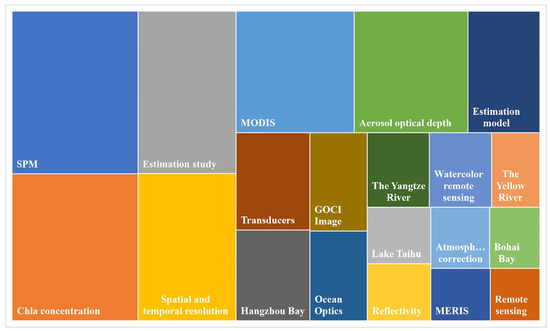
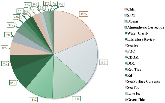
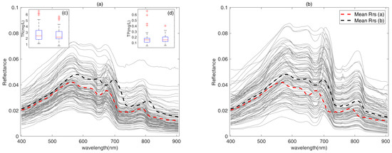
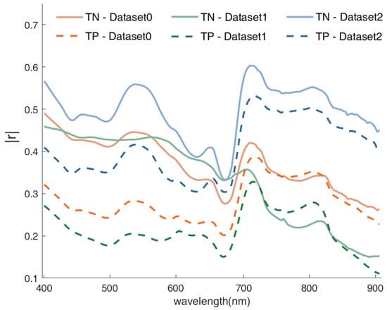
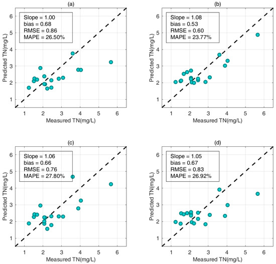
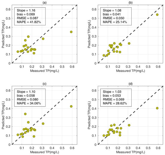
In recent decades, eutrophication in inland and coastal waters (ICWs) has increased due to anthropogenic activities and global warming, thus requiring timely monitoring. Compared with traditional sampling and laboratory analysis methods, satellite remote sensing technology can provide macro-scale, low-cost, and near real-time water quality monitoring services. The Geostationary Ocean Color Imager (GOCI), aboard the Communication Ocean and Meteorological Satellite (COMS) from the Republic of Korea, marked a significant milestone as the world’s inaugural geostationary ocean color observation satellite. Its operational tenure spanned from 1 April 2011 to 31 March 2021. Over ten years, the GOCI has observed oceans, coastal waters, and inland waters within its 2500 km × 2500 km target area centered on the Korean Peninsula. The most attractive feature of the GOCI, compared with other commonly used water color sensors, was its high temporal resolution (1 h, eight times daily from 0 UTC to 7 UTC), providing an opportunity to monitor ICWs, where their water quality can undergo significant changes within a day. This study aims to comprehensively review GOCI features and applications in ICWs, analyzing progress in atmospheric correction algorithms and water quality monitoring. Analyzing 123 articles from the Web of Science and China National Knowledge Infrastructure (CNKI) through a bibliometric quantitative approach, we examined the GOCI’s strength and performance with different processing methods. These articles reveal that the GOCI played an essential role in monitoring the ecological health of ICWs in its observation coverage (2500 km × 2500 km) in East Asia. The GOCI has led the way to a new era of geostationary ocean satellites, providing new technical means for monitoring water quality in oceans, coastal zones, and inland lakes. We also discuss the challenges encountered by Geostationary Ocean Color Sensors in monitoring water quality and provide suggestions for future Geostationary Ocean Color Sensors to better monitor the ICWs.
Full article
(This article belongs to the Special Issue Remote Sensing Retrievals of Optical Properties in Inland Waters and the Coastal Ocean)
►
Show Figures
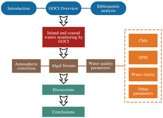
Figure 1

