


Water 2024, 16(9), 1294; https://doi.org/10.3390/w16091294 (registering DOI) - 02 May 2024
Abstract
As critical equipment in nuclear power systems, the stability of circulating water pumps (CWP) directly impacts the efficiency of power plants. To investigate the impact mechanisms of the unsteady flow characteristics and flow-induced forces on the rotation system, numerical simulation methods were employed
[...] Read more.
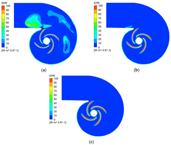
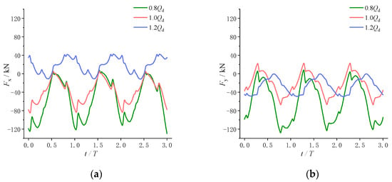
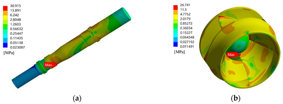
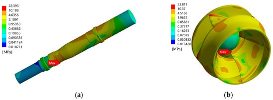
As critical equipment in nuclear power systems, the stability of circulating water pumps (CWP) directly impacts the efficiency of power plants. To investigate the impact mechanisms of the unsteady flow characteristics and flow-induced forces on the rotation system, numerical simulation methods were employed to calculate the internal flow of a volute mixed-flow CWP under different flow rates (0.8Qd, 1.0Qd, 1.2Qd). The flow field results indicate that, under the part-load condition, the flow within the volute is chaotic with high energy losses, while under the over-load condition, there is a significant velocity gradient within the impeller, leading to relatively severe flow losses. Additionally, the rotor–stator interface is a major factor in flow-induced pulsations, and the asymmetric pressure distribution within the volute results in radial force imbalance. The finite element method (FEM) results indicate that the position of maximum stress on the pump shaft is closely related to the ratio of radial and axial force. Increasing the flow rate appropriately has been noted to be advantageous in reducing flow-induced forces and their amplitude, consequently diminishing the forces on the rotation system and improving the long-term operational stability of the CWP.
Full article
(This article belongs to the Section Hydraulics and Hydrodynamics)
►
Show Figures
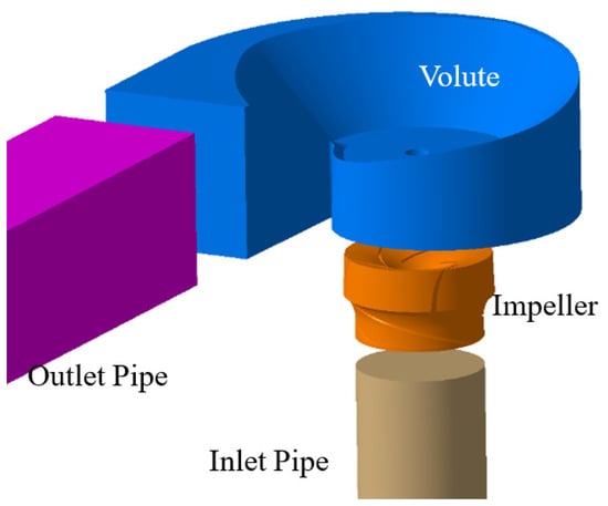
Figure 1


