


Water 2024, 16(9), 1286; https://doi.org/10.3390/w16091286 (registering DOI) - 30 Apr 2024
Abstract
►
Show Figures
Robust and accurate flood hazard maps are essential for early warning systems and flood risk management. Although physically based models are effective in estimating pluvial flooding, the computational burden makes them difficult to use for real-time flood prediction. In contrast, data-driven models can
[...] Read more.
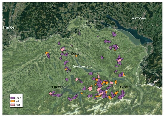
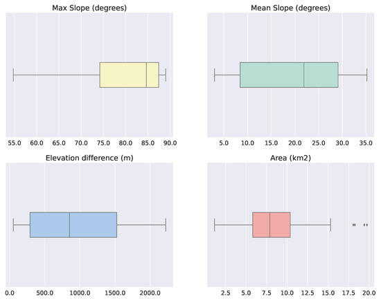
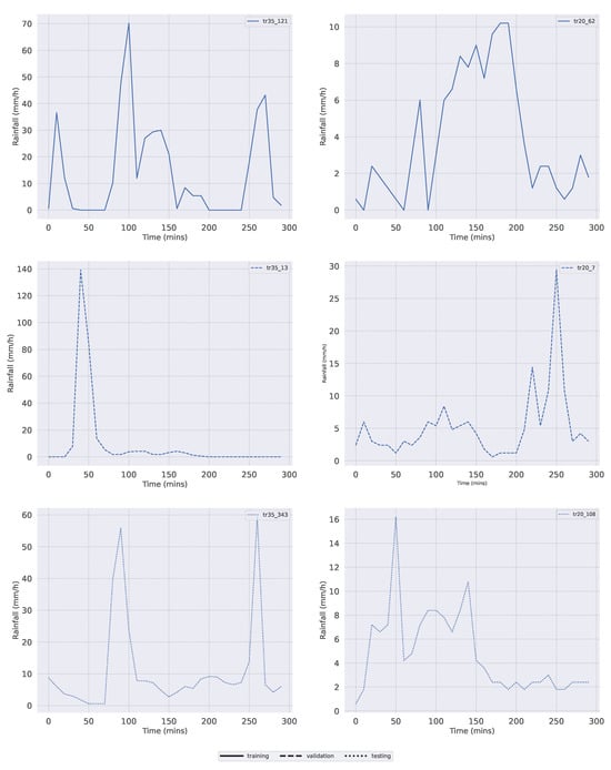
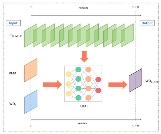
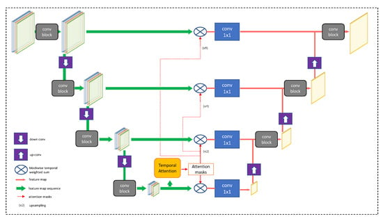
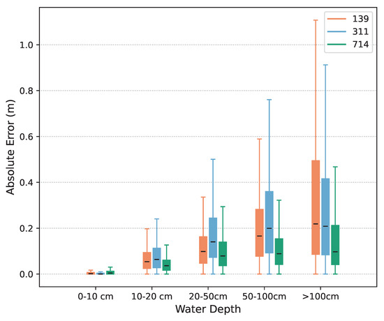
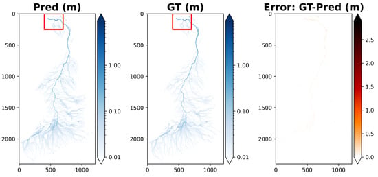
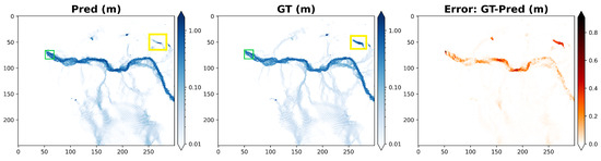
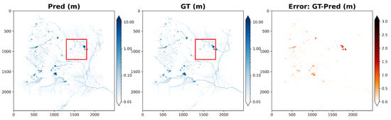
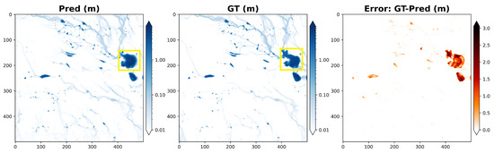
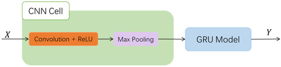
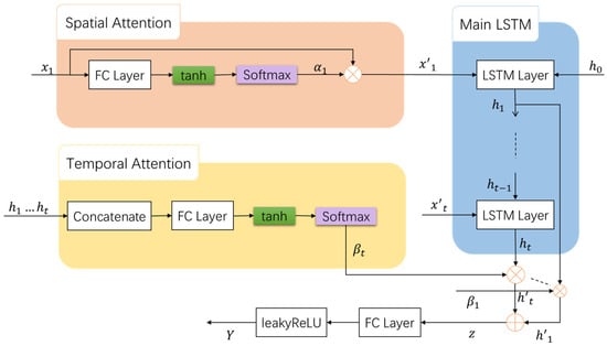
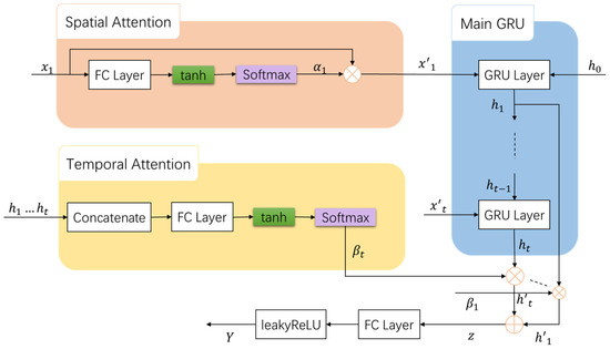
Robust and accurate flood hazard maps are essential for early warning systems and flood risk management. Although physically based models are effective in estimating pluvial flooding, the computational burden makes them difficult to use for real-time flood prediction. In contrast, data-driven models can provide faster flood predictions if trained offline. While most studies have focused on predicting maximum water depth, in this study, we predict pixel-wise water depth maps for entire catchments at a lead time of 2 h. To that end, we propose a deep learning approach that uses a sequence encoding network with temporal self-attention. We also adapt the popular hydrological performance metric Nash–Sutcliffe efficiency (NSE) as our loss function. We test the effectiveness and generalizability of our method using a new dataset called SwissFlood, which consists of 100 catchments and 1500 rainfall events extracted from real observations in Switzerland. Our method produces 2 m spatial resolution flood maps with absolute error as low as 27 cm for water depth exceeding 1 m.
Full article
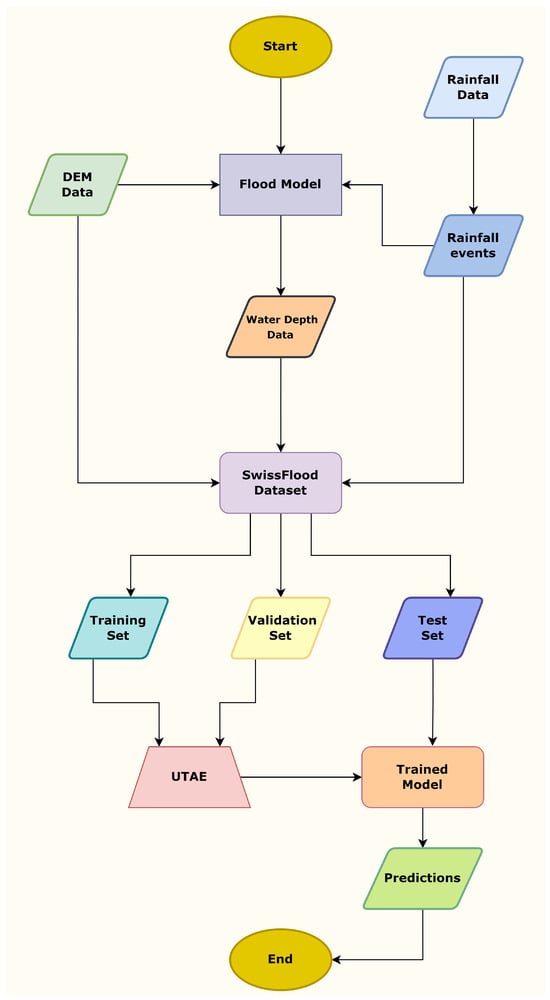
Figure 1


